Mellor Country House

Mellor Country House is a lovely tranquill place to visit and is a wonderful charity.


Mellor Country House is a UK charity, built in 1907,set in three acres of garden and woodland located in the pretty village of Mellor, situated on the border between Greater Manchester and the High Peak . The charity is dedicated to providing respite breaks for groups, families, carers and individuals primarily from the nearby urban areas who could not, otherwise, have a break at all.

The Charity’s aim is to provide a safe, secure, relaxing and uplifting environment for the financially and socially disadvantaged. For many of the people who stay at the house, this break from the hardships of their day-to-day existence can, literally, be a life-saver.

Accommodation for up to 24 guests is provided in 11 bedrooms on a self-catering basis with a well equipped kitchen, dining room, restful lounges and children’s playroom. Outside, the grounds include a secure play area for toddlers, a bike track for the older children, a paved patio with barbeque, a private lawn area with benches and seating for quiet reflection. Quoted from http://www.mellorcountryhouse.co.uk/index.asp


Please look at their website : http://www.mellorcountryhouse.co.uk/index.asp


The local areas I work/ cover in is Romiley , Stockport , Woodley, Bredbury , Hyde , Gee Cross , Hazel Grove , Godley , Disley , Marple , Marple Bridge , Glossop , Poynton , Higher Poynton , New Mills , Hayfield , Whaley Bridge , Mellor. If you are not situated in one of these areas do not hesitate to contact me as other areas are considered. These do not apply for home boarding.

Aussie Dog Care Email : ATHOMPS1@sky.com

Aussie Dog Care Facebook : https://www.facebook.com/AussieDogCareUk for updates when you go away for peace of mind as well as some walking clients.

Aussie Dog Care Twitter : https://twitter.com/AussieDogCare

Aussie Dog Care

The Best Care For Your Furry Friends.

Tailoring to your needs

Marple Bridge with Pictures!

I have taken some photographs of Marple Bridge and quoted some information on one of Aussie Dog Cares many dog walks!

“Marple Bridge is a village within the Metropolitan Borough of Stockport, in Greater Manchester, England. It lies on the River Goyt, which runs through the centre of the village, and is close to the town of Marple.

Historically a part of the civil parish of Glossop, in Derbyshire, it was included in the new parish of Ludworth and Chisworth in 1866.[1] Ludworth became a separate parish in 1896, and was abolished in 1936, when the former parish was transferred to Cheshire and amalgamated into Marple Urban District.[2] In 1974 the urban district was abolished and Marple Bridge became part of the Metropolitan Borough of Stockport in the county of Greater Manchester. It shares borders with Mellor, Marple, Compstall,New MillsStrines, Mill Brow and Chisworth. It is located in the ecclesiastical parish of Mellor and the parish church of St Thomas, Mellor stands several hundred feet higher than the village, overlooking Marple Bridge, Marple, Greater Manchester and Cheshire.

Marple Bridge village centre has been designated a Conservation Area. The Conservation Area was originally established in 1974, although was extended in 2006 to incorporate Brabyns park.[3]

Stockport Metropolitan Borough Council has produced a Conservation Area Character Appraisal document, outlining the reasons that the Conservation Area has been designated as such. In justifying the reasons for designation, this document states of the town: “Marple Bridge is a predominately stone-built village situated on the banks of the River Goyt, just to the north east of Marple… Historically the location had significance as a bridging point on the route between Stockport and Derbyshire and where water power was available initially for a forge and corn mill. Marple Bridge developed from the 18th century as a small urban centre” Quoted from http://en.wikipedia.org/wiki/Marple_Bridge

Please check out this website for information on the winter wonderland this year and all things Marple Bridge! http://www.marplebridgeassociation.org.uk/

See pictures below:

Marple Bridge.
Marple Bridge.
Marple Bridge
Marple Bridge
Marple Bridge.
Marple Bridge.
Marple Bridge
Marple Bridge

The local areas I work/ cover in is Romiley , Stockport , Woodley, Bredbury , Hyde , Gee Cross , Hazel Grove , Godley , Disley , Marple , Marple Bridge , Glossop , Poynton , Higher Poynton , New Mills , Hayfield , Whaley Bridge , Mellor. If you are not situated in one of these areas do not hesitate to contact me as other areas are considered. These do not apply for home boarding.

Aussie Dog Care Email : ATHOMPS1@sky.com

Aussie Dog Care Facebook : https://www.facebook.com/AussieDogCareUk for updates when you go away for peace of mind as well as some walking clients.

Aussie Dog Care Twitter : https://twitter.com/AussieDogCare

Aussie Dog Care

The Best Care For Your Furry Friends.

Tailoring to your needs

Roman Bridge and Lakes in Marple.

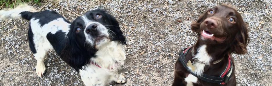
We really love our walks at Aussie Dog Care around marple so here in another fantastic and informative walk around The Roman Bridge and Lakes in Marple.

All text below is quoted from http://www.marple-uk.com/roman.htm the pdf files of this walk is avalible on their website . It is really informative and fantastic for dogs walks and family strolls.

“1) We start in the Memorial Park in the centre of Marple, home of Thomas Carver one of the owners of Hollins Mill and another of Marple’s benefactors in a later period. (Memorial Park was gifted to the people of Marple in July 1922).

2) At the junction with Arkright Road cross over and down Lakes Road. On the left where there is now a group of bungalows stood the cottages of Stone Row. The 35 cottages were built by Oldknow to house the workers at his nearby mill and their families.Carry on ahead past Beechwood Manor, formerly a house belonging to the railway but now private flats. Beechwood Manor was once the residence of Edward Ross, secretary of the M.S.L. Railway. When Ross lived here there was a footbridge connecting the manor to the garden above Marple South Tunnel. Sadly this was removed sometime in the 1970s but you can still see where it was attached to the stonework on both sides. As we descend the hill we can appreciate the difficulties the railway engineers must have experienced when carving the line along the hillside.

3) At the bridge over the River Goyt stood, on the far side, Mellor Lodge, Samuel Oldknow’s house and on this side Marple Lodge, the mill manager’s house.

In the 1930s Oldknow’s fine house became a girls’ school but later it was vandalised when it stood empty and was demolished in 1949.

In 1892 a disastrous fire destroyed the mill but the Corn Mill, which was a little apart from the main mill, escaped damage and survived until the 1930s. The Corn Mill stood close to this junction of the two paths. Little remains of Mellor Mill or Oldknow’s other buildings in this area but close investigation of the site will reveal a number of underground tunnels and foundations. In 2009 the Mellor Archaeological Trust exposed the foundations of the Corn Mill and led guided walks around the remains.Looking to the left as we make our way up Lakes Road we can see the mill pool, which was adjacent to the back of the mill. The oval shaped shuttle stone, dated 1790, that can be made out in the triangular pediment at the top of the mill in the old image below is now in Marple Memorial Park. You can see it in the foreground of the image of Hollins House at step 1 of this guide.

5) At the next junction take the path to the right. Through the trees you can see Bottoms Hall built in 1800. This is where some of the 100 apprentices lived who worked in Oldknow’s mill. The children, both boys and girls, were mostly paupers from Clerkenwell in London. They worked 13 hours a day for 4 shillings (20p) a week, but it is understood that they were well treated by the standards of that time.ontinuing along the track we pass the Roman Lake. This was a very popular spot in Victorian and Edwardian times when excursion trains would bring hundreds of visitors to Marple Station. Besides the rowing boats available for a small charge there were tea rooms and a dance floor.A little further on the river runs alongside the track and under the viaduct. The weir is where Oldknow redirected the river to form the pools that would provide water power for his mill. On the left is Flood Gates Cottage which many years ago was a popular place for refreshments for the many visitors to the area.


A little further on the river runs alongside the track and under the viaduct. The weir is where Oldknow redirected the river to form the pools that would provide water power for his mill. On the left is Flood Gates Cottage which many years ago was a popular place for refreshments for the many visitors to the area.

6) The track moves away from the river and we turn right just by the “Roman Lodge” (following the sign to Strines) to reach the Roman Bridge. The “Roman” tag was coined in Victorian times to add a little romanticism to this packhorse bridge dating back to the 17th century.

Crossing the bridge we follow the path beside the river ignoring the steps on the right. The path joins a narrow road near two cottages and then makes its way up the hill to Strines Road. Cross over and up Plucksbridge Road. As the canal is reached, turn right to enter the towpath just before the bridge.

7) This is the Peak Forest Canal and Oldknow was a major sponsor for this waterway. The canal runs 6½ miles to Whaley Bridge and Buxworth and it was here that limestone was brought down from the Peak District by tramway. As we make our way along the towpath there are extensive views across the valley to Cobden Edge and Mellor Church.

Brickbridge is a roving bridge where the towpath changes sides and you will notice that we pass under the bridge before circling round to cross it. This was to enable the rope of the horse drawn narrowboats to remain attached.8) Some 200 yards short of Brickbridge the canal on the far side is a little wider, and marshy ground leads into a woody section. This was the site of one of Oldknow’s coal mines used for burning of the lime in the kilns.

As you cross the bridge you will notice a door set in the wall ahead. This leads to another Oldknow coal mine and also a footpath leading up to All Saints’ Church which was used by the apprentices on their way to Sunday worship.

9) Turning right to follow the towpath, ahead we can see a number of boats moored in a pool off the main canal. This was adjacent to the top of the Lime Kilns where the lime and coal was dropped into the kilns. Such was Oldknow’s concern that the Lime Kilns did not present an eyesore, that he built them in a gothic style that led later to visitors to the area to assume it was a ruined abbey.

Top Lock House was the site of James Jinks boat building yard. Cross the bridge at the Macclesfield Canal junction. [ If you would like too see what remains of the Lime Kilns cross the bridge at the end of the top lock and go on past the bungalows.]


Make your way past the top four locks of this flight of sixteen. Pass under Posset Bridge using the short horse tunnel and make your way back to the car park”

The local areas I work/ cover in is Romiley , Stockport , Woodley, Bredbury , Hyde , Gee Cross , Hazel Grove , Godley , Disley , Marple , Marple Bridge , Glossop , Poynton , Higher Poynton , New Mills , Hayfield , Whaley Bridge , Mellor. If you are not situated in one of these areas do not hesitate to contact me as other areas are considered. These do not apply for home boarding.

Aussie Dog Care Email : ATHOMPS1@sky.com

Aussie Dog Care Facebook : https://www.facebook.com/AussieDogCareUk for updates when you go away for peace of mind as well as some walking clients.

Aussie Dog Care Twitter : https://twitter.com/AussieDogCare

Aussie Dog Care

The Best Care For Your Furry Friends.

Tailoring to your needs

Walking Route around Chadkirk

When looking on the internet a while back I found a great article on a walk around Chadkirk and here it is,   quoted from http://www.marple-uk.com/chadkirk.htm . At Aussie Dog Care we enjoyed this historic walk and the information on marple uk was fantastic on informing me about Chadkirk and the surrounding areas past.

“1)     On leaving the Car Park adjacent to Rose Hill station make your way    back to Stockport Road, cross the zebra crossing and turn left. After about 100 yards turn    right into Marple Hall Drive. Follow this road for about 400 yards until it makes a right    angle turn.

2)     Proceed straight ahead, past the site of Marple Hall. This stately mansion was where John Bradshawe lived as a    young man. In later life in his role as President of the High Court of Justice he signed    King Charles I death warrant.

Unfortunately in the    1950s, after the caretaker died, the vandals moved in and reduced the building to a ruin    in a matter of months.

The ground falls away steeply to your right    and although there are a number of paths leading down, follow the main path alongside the    edge of the playing fields of Marple Hall School.

Through the trees you will be able to see the    River Goyt in the valley. The Goyt and the Tame combine near Stockport to form the River    Mersey.

3)     The path eventually drops down to Dooley Lane. Turn right past the    Garden Centre and over Otterspool Bridge. This was the extreme boundary of the old forest    of Macclesfield. After a short distance turn right past the car park and follow the road    to Chadkirk Chapel.

Chadkirk has the distinction, unlike Marple, of being mentioned in the Domesday Book. The whole manor was 3 miles long and 11/2 miles wide of which most was woodland. The value was assessed to be worth 10 shillings.

4) Although legend has it that Chadkirk is associated with the 7th century missionary St Chad, the present Chapel dates back to the early 16th century although it has been restored on a    number of occasions since then. The building is now owned by Stockport Council and is open    to the public on Saturday and Sundays between 1.00 pm and 5.00 pm (admission free). There    is an audio/visual show giving the history of the chapel and St. Chad.

Adjoining the chapel is a farm which is also open to the public at certain times.

Follow the road past the farm. On the left as you go up the hill you will pass St Chad’s Well and an information board gives you details    of this historic site.

At the top of the hill some stone steps on the right take you up to the canal.

5) At this point you have the first choice of route. See below for alternative Route B.

On    reaching the canal turn right along the towpath. As you will see the canal has been cut    out of the steep hillside and its construction over 200 years ago is a monument to the skill of the canal engineers of the time with the limited resources available to them.

6) Opposite the canalside factory is a path on the right for alternative Route C. See bottom of page for details.

Shortly after passing the factory the canal enters the    308 yard Hyde Bank tunnel which although only being a short tunnel has no towpath    requiring horsedrawn narrowboats to be legged through. Take the path over the top passing    a farm before bearing right and following a steepish path down to rejoin the canal.

The canal continues its path along the side    of the hill until, after passing under a bridge, it enters a relatively narrow section for    a hundred yards or so. This was formerly Rose Hill tunnel which collapsed over 100 years    ago and rather than rebuild it they opened it up. In 1997 the embankment became unstable    and had to be strengthened, substantially, at a cost of £300,000.

Just ahead the canal crosses the    Marple Aqueduct. This magnificent structure built 200 years ago stands 100ft above the    river Goyt. In the early 1960s this structure was faced with closure when a severe frost    so badly damaged it that it was uncertain whether it would ever reopen to navigation. As a    consequence the flight of locks also fell into disrepair and it was only the sterling    efforts of a group of enthusiasts who formed the Peak Forest Canal Society that eventually    both the aqueduct and locks were saved.

7) Continue    alongside the locks until you reach lock 7 where you cross the bridge close to the bottom    gates and head for a footpath marked with two metal stakes.

This path, after about    150 yards, meets up with Winnington Road. Cross over and make your way up Grosvenor Road.    At the junction with Manor Road continue straight ahead to a footpath known as Seven    Stiles. The stiles have long gone but the footpath happily remains. Follow the path which    after about 200 yards crosses a road before leading down to another path. After a short    distance you follow the boundary of Marple Cricket Club.

Eventually the path terminates on Bowden    Lane. Turn right and over the railway bridge. Turn left onto Dale Road and follow this to    Stockport Road. The car park is just across the road.”

Chadkirk Chapel From http://www.picturesofengland.com/img/L/1032657.jpg

The local areas I work/ cover in is Romiley , Stockport , Woodley, Bredbury , Hyde , Gee Cross , Hazel Grove , Godley , Wilmslow , Disley , Marple , Marple Bridge , Glossop , Poynton , Higher Poynton , New Mills , Hayfield , Whaley Bridge , Mellor. If you are not situated in one of these areas do not hesitate to contact me as other areas are considered. These do not apply for home boarding.

Aussie Dog Care Email : ATHOMPS1@sky.com

Aussie Dog Care Facebook : https://www.facebook.com/AussieDogCareUk for updates when you go away for peace of mind as well as some walking clients.

Aussie Dog Care Twitter : https://twitter.com/AussieDogCare

Aussie Dog Care

The Best Care For Your Furry Friends.

Tailoring to your needs.